
Lougheed Corridor Concept Framework
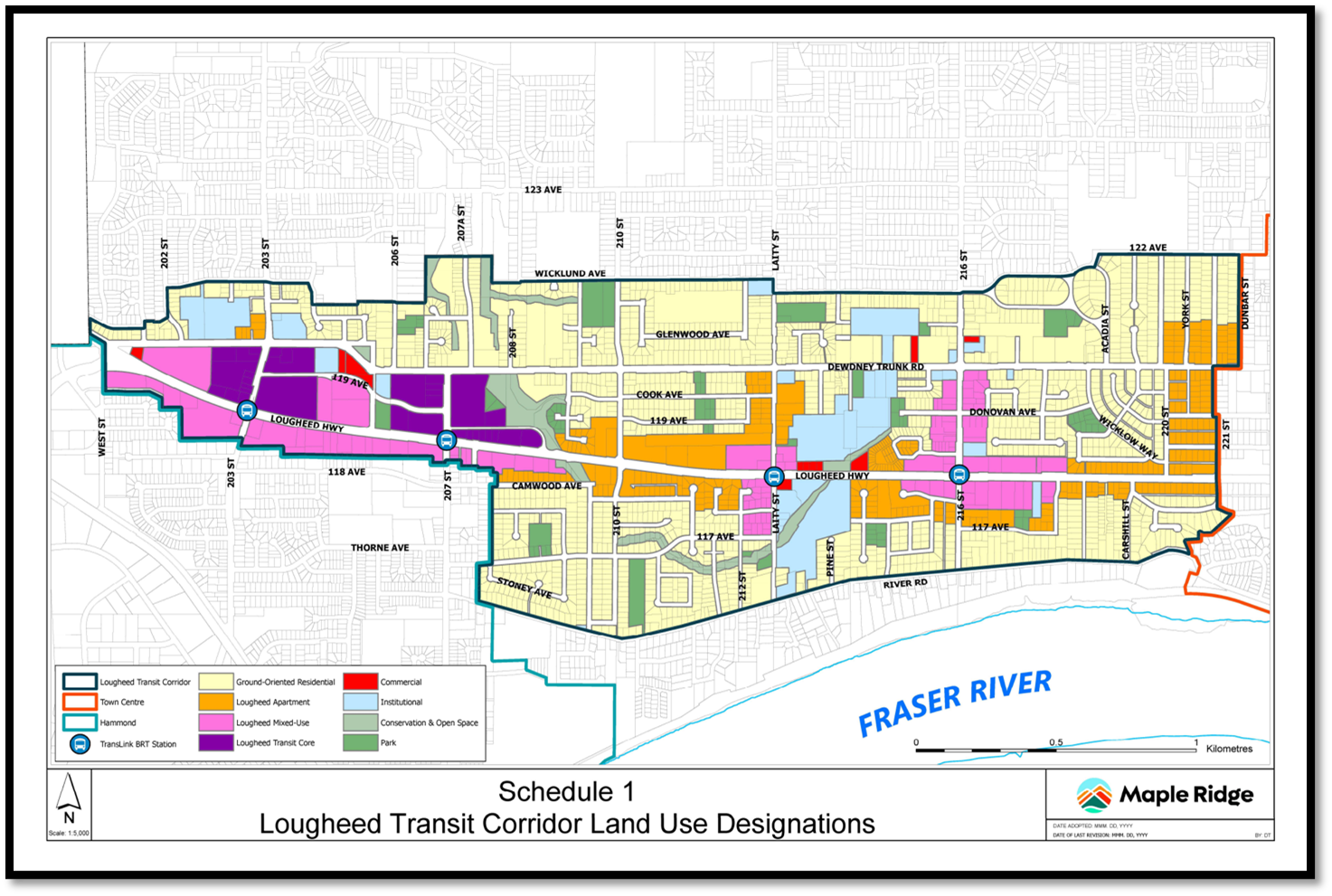
Land Use Designations
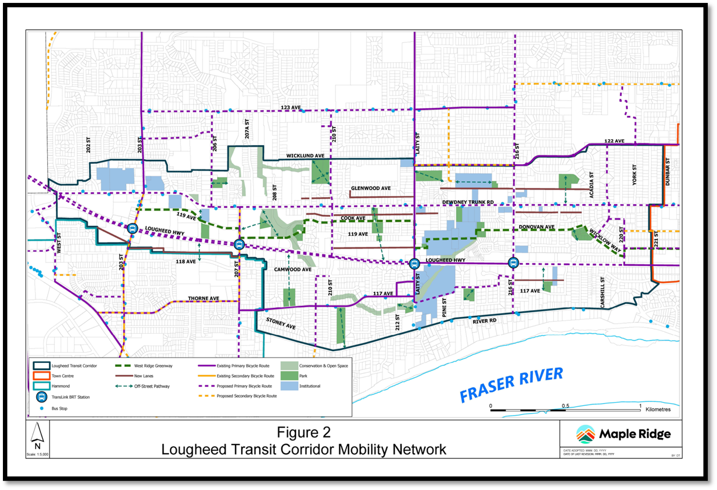
Detailed Mobility Network
Lougheed Transit Corridor Area Plan, Maple Ridge, BC (2023 – 2026)
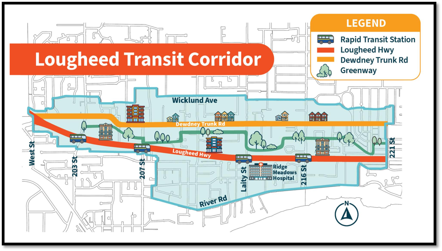
MVH supported the City of Maple Ridge staff team develop the Lougheed Transit Corridor Area Plan (LTCAP) including land use, mobility, and urban design. Michael von Hausen of MVH helped facilitate a series of interactive staff workshops to help shape the Plan structure. A series of Transit Oriented Development (TOD) nodes evolved, each with their own unique set of uses, densities as well as different forms and characters. A central greenway provides a backbone to the pedestrian and bicycle network that connects the necklace of parks and open spaces. The LTCAP Plan provides development intensity and increased mobility along the Lougheed Corridor yet largely retains the character of existing neighbourhoods along its outer edges.